The driving force for Copernicus
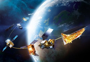
A global monitoring programme
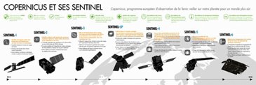
Copernicus is the world’s most ambitious Environment and Climate monitoring programme. It comprises satellites for “in-situ” measurement and derived “services” addressing six specific topics: oceans, atmosphere, climate change, land, security and management of emergency situations.
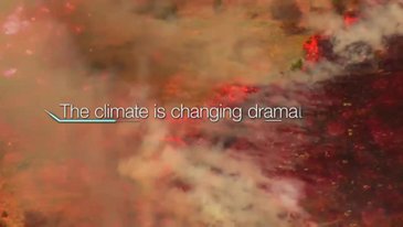
An eye on climate
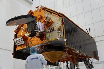
Airbus plays a crucial role in constructing the satellites and instruments for the Copernicus programme:
- Developing and building the radar instrument for Sentinel-1
- Prime contractor for Sentinel-2 and a spectral mode observations instrument
- Designing and building the microwave radiometer (MWR) onboard Sentinel-3
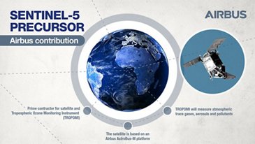
- Designing and building the satellite and instrument for Sentinel-5 Precursor (5P)
- Prime contractor for the two spectrometers on Sentinel-4
- Prime contractor for the Sentinel-5 imaging spectrometer
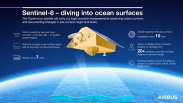
- Prime contractor for Sentinel-6
- Prime contractor for CRISTAL
- Prime contractor for LSTM
- Building radars for ROSE-L
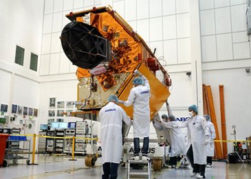
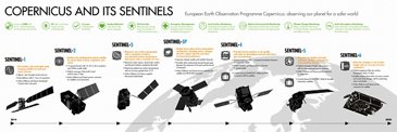
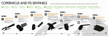
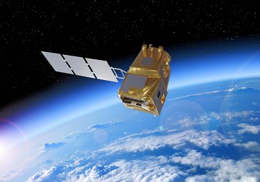
Sentinel-1
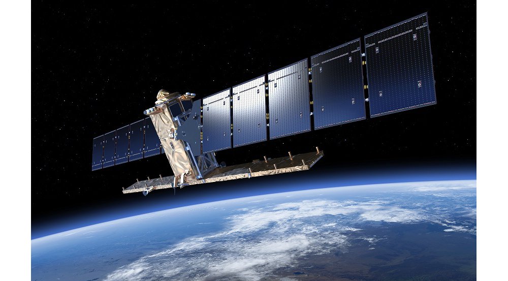
The twin Sentinel-1 satellites are designed to provide radar-based Earth observation imagery, which is significantly higher in quality than imagery from predecessor missions.
The first of these satellites – Sentinel-1A – was launched in 2014, followed two years later by Sentinel-1B. Two more satellites are in production.
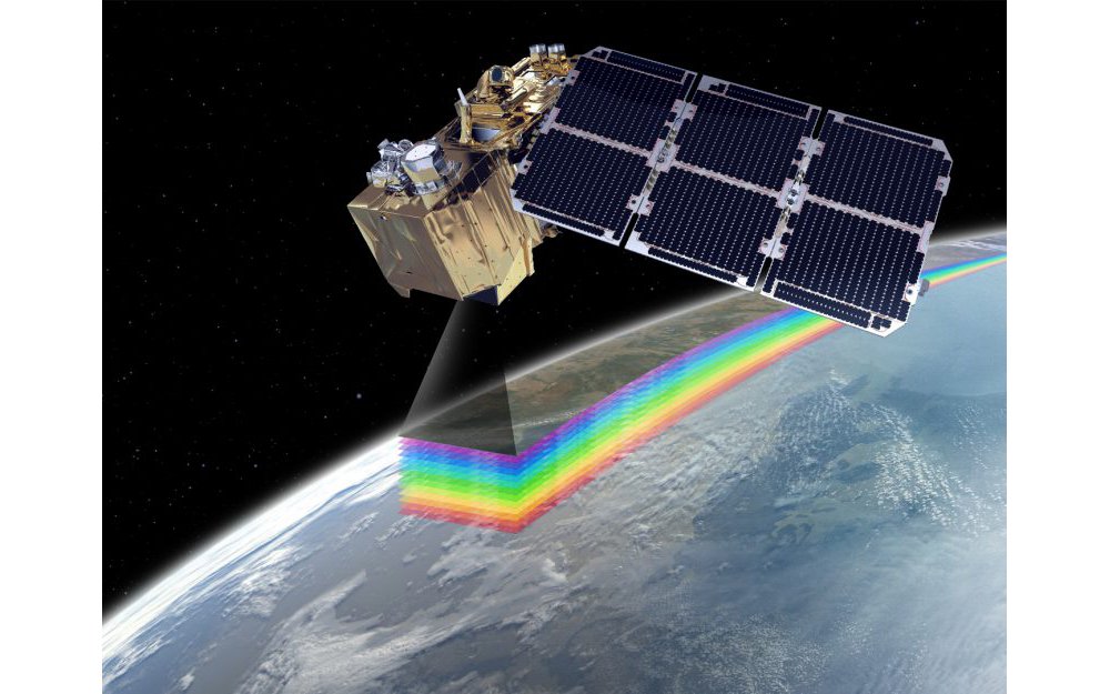
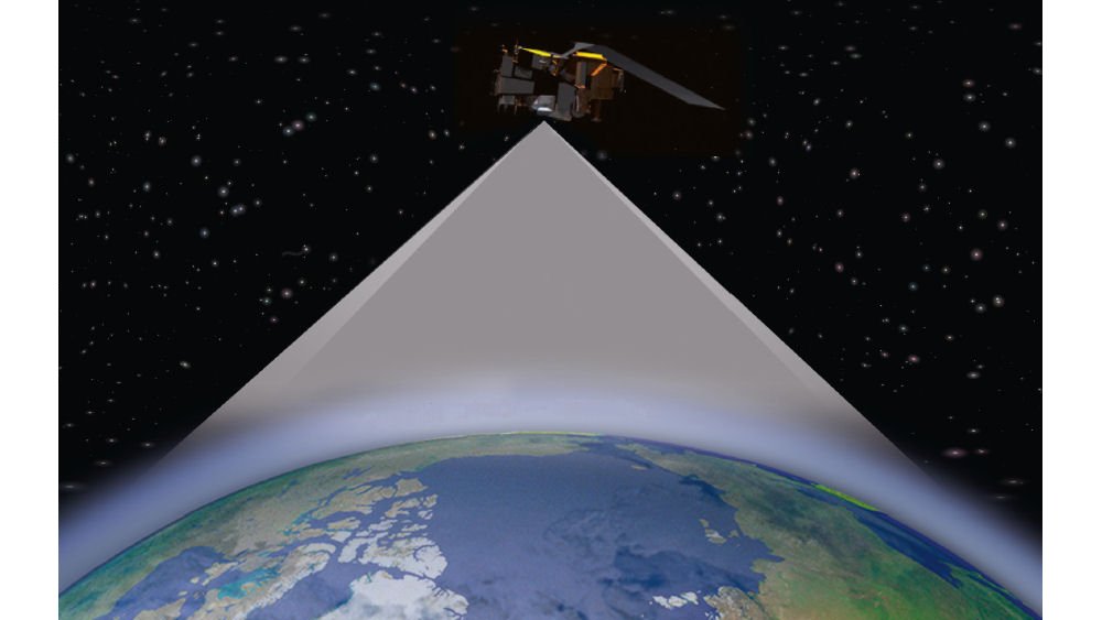
Sentinel-2
Airbus is prime contractor for this two-satellite mission. Sentinel-2A was delivered to orbit in 2015, while its Sentinel-2B counterpart was launched in 2017. Two more satellites are in production.
The extracted data is primarily used for monitoring natural disasters (floods, forest fires, landslides, erosion) and in the fields of land use (soil sealing, spatial planning, forestry management), humanitarian aid, as well as for coastal monitoring.

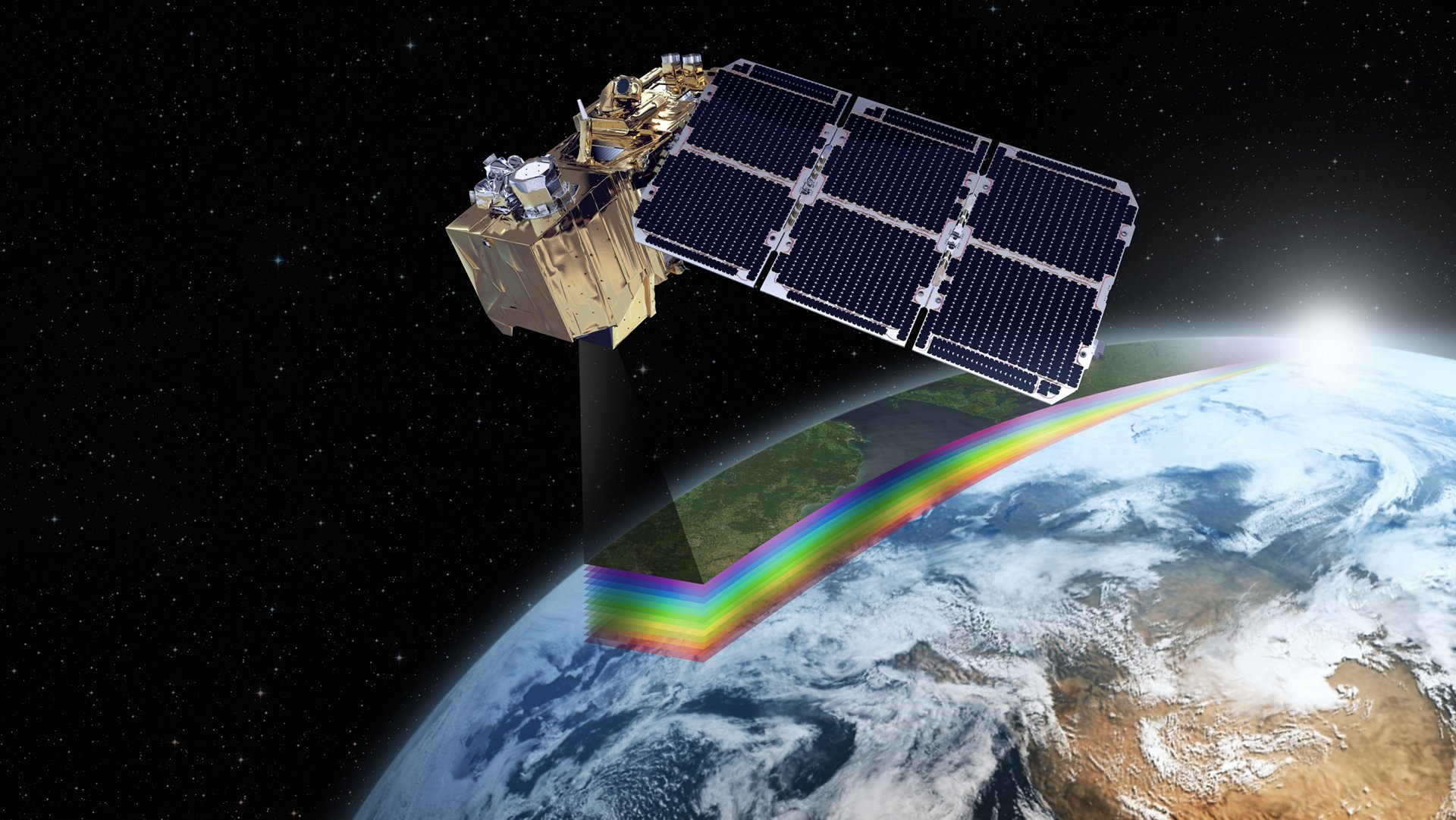
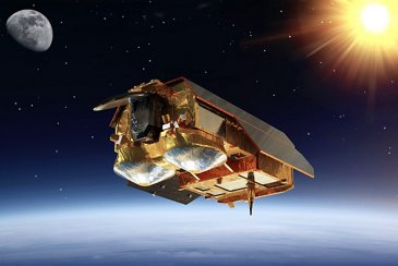
Sentinel-3
Sentinel-3 is dedicated to oceanography and vegetation monitoring. The two satellite components – Sentinel-3A and Sentinel-3B – were launched in 2016 and 2018, respectively. A further two satellites are in production.Airbus supplies this mission’s Microwave Radiometer – which determines the amount of humidity contained in the path of the radar pulses – as well as a number of satellite subsystems.

Sentinel-4
The Sentinel-4 mission will concentrate on services that include analysing the chemical composition of the atmosphere and monitoring air quality. Its primary task is to measure concentrations of aerosols, trace gases and cloud cover in the lower troposphere.
Airbus is prime contractor for the development and construction of its two spectrometers.

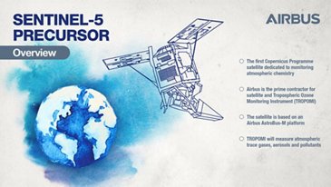
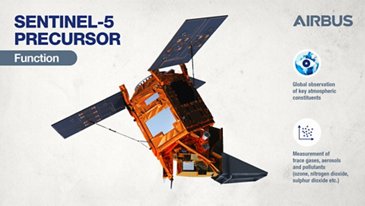
Sentinel-5 Precursor
Launched in 2017, Sentinel-5 Precursor (Sentinel-5P) is the first satellite dedicated to monitoring atmospheric chemistry for the Copernicus programme.
Sentinel-5P ensures the continuity of data to monitor the ozone hole and tropospheric pollution. Sentinel-5P is filling the gap between current atmospheric capabilities from polar Earth orbit and the launch of Sentinel-5.
Sentinel-5
The high-precision Sentinel-5 instrument will monitor Earth’s atmosphere globally and daily by taking measurements of trace gases and aerosols that have an impact on the climate and air quality. Sentinel-5 will be installed on an Airbus-built MetOp Second Generation satellite and fly in a roughly 800-kilometre polar orbit around the Earth.

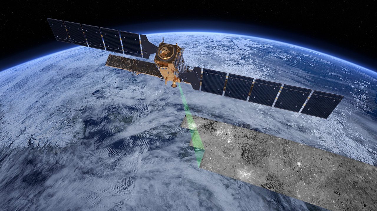
Sentinel-6
Sentinel-6 is a mission to carry out high-precision measurements of ocean surface topography.
The satellite measures its distance to the ocean surface with an accuracy of a few centimetres and uses this data to map surface topography globally, repeating the cycle every 10 days. The measurements are vital for modelling the oceans and predicting rises in sea levels.
In 2020, ESA approved additional missions to expand the capabilities of the Copernicus programme.

CRISTAL: Copernicus Polar Ice and Snow Topography Altimeter
The two Airbus-built CRISTAL spacecraft will monitor sea-ice thickness and overlying snow depth using dual-frequency radar altimeter and microwave radiometer technology from Airbus.
The data will support maritime operations in polar oceans and contribute to a better understanding of climate processes. CRISTAL will also support applications related to coastal and inland waters and the observation of ocean topography.

LSTM: Copernicus Land Surface Temperature Monitoring
The LSTM mission will help farmers achieve sustainable agricultural production at field-scale in a world of increasing water scarcity. The two satellites will be able to identify the temperatures of individual fields and image the Earth every three days at 50 m resolution. This is about 400 times more detail than is currently acquired from space.
Airbus is prime contractor for this next generation satellite, including its high spatial-temporal resolution thermal infrared sensor.

ROSE-L: L-band Synthetic Aperture Radar
Since longer L-band signals can penetrate through many natural materials – such as vegetation, dry snow and ice – the ROSE-L mission will complement the information gathered by the Copernicus Sentinel-1 C-band radar mission – supporting forest management, precision farming and food security and ocean monitoring.
The radar antenna will be the largest planar antenna ever built measuring an impressive 11 metres by 3.6 metres.
Going further

Sentinel satellites benefit from the SpaceDataHighway services provided by Airbus. The Sentinel-1 and Sentinel-2 satellites are equipped with laser communication terminals that significantly accelerate the delivery of time-critical data and large volumes of data to Earth monitoring centres.
Media

The European Space Agency (ESA) has selected Airbus Defence and Space as prime contractor for the new Land Surface Temperature Monitoring (LSTM) mission. LSTM is part of Copernicus, the European Union's Earth observation programme for global monitoring. It is one of the six new missions, expanding the capabilities of the current Copernicus space component.
With launch planned in 2027, CRISTAL will carry an advanced multi-frequency altimeter that will measure sea ice thickness and ice sheet elevations. These data will support maritime operations in polar oceans and contribute to a better understanding of climate processes. CRISTAL will also support applications related to coastal and inland waters and the observation of ocean topography.


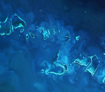
Great Barrier Reef: The Copernicus Sentinel-2A satellite image over part of the Great Barrier Reef off Australia’s northeast coast. Extending more than 2000 km and covering an area of some 350 000 sq km, it is the planet's biggest single structure made by living organisms, called coral polyps. The reef is home to over 1500 tropical fish species, 400 types of coral, more than 200 species of bird, 5000 species of mollusc, 500 species of seaweed and six species of sea turtle. It is also a breeding area for humpback whales.
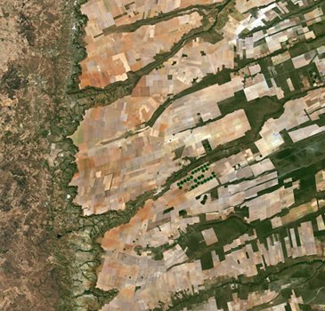
Copernicus Sentinel-2A image over central-eastern Brazil. It shows a large, flat plateau blanked with fields benefiting from rich soils and an apparent abundance of water, before falling off into a green, hilly valley (left). The straight lines in the image are roads, such as the highway running in a nearly straight line from the centre-top to bottom of the image. A distinctive feature in this image is the circles – mainly at the centre. These shapes were created by a central-pivot irrigation system, where a long water pipe rotates around a well at the centre of each plot. The varying colours show different types of crop, or different stages of growth.